


ABOUT
The Infraplan Group is a collective of specialized consulting firms spanning Brazil, the United States, and Peru. We deliver advanced solutions in traffic engineering, transportation, and logistics, powered by an experienced team dedicated to leveraging the most modern methodologies and technologies for exceptional technical excellence
The services carried out in the different countries where we operate total:
projects
projects
served
Our mission is to conduct studies and projects that promote the development of efficient, safe, and sustainable transportation infrastructures and systems. Our values are technical excellence, client focus, and innovation.
OUR SERVICES
Infraplan Consult focuses on multimodal transportation systems and infrastructure for both the urban and rural environments. Also, our expertise extends to local, long-distance, and regional-level freight logistics, including highways and freeway systems, railroads, and terminal operations.


LEADERSHIP TEAM
With extensive experience in consulting, Infraplan has a team of engineers with graduate degrees in transportation who have the necessary knowledge to fully meet the expectations of our clients.
Saulo Horta Barbosa
Founding partnerExecutive director

Leandro Piassi
Founding partnerProduction director

Silvestre de Andrade Puty Filho
Founding partnerStrategy director

Gustavo Riente de Andrade
PartnerAssociate director (USA)

Letícia Souza Faria
PartnerAssociate director (comercial)

Marcus Vinicius Ferreira
PartnerAssociate Director (multimodal projects)

Julio Eymard Werneck Costa
PartnerProject Manager

Marcela Alves Lomasso
PartnerProject Manager

TOOLBOX
Infraplan has registered licenses, subscriptions, and extensive knowledge in the use of the latest versions of some of the main traffic and transportation engineering software and reference manuals. Learn more about some of these tools.
TRANSCAD
This transportation software integrates a Geographic Information System with a transportation planning and modeling tool that analyzes travel demand, trip distribution, mode choice, and network performance. It can be used to evaluate transportation alternatives and develop transportation plans for different regions.
TRANSMODELER
TransModeler is a traffic microscopic simulation software that can be used to model and evaluate transportation alternatives, traffic management strategies, and infrastructure projects, among other applications. It uses advanced traffic simulation algorithms to model vehicles individually and simulate complex traffic scenarios such as roundabouts, highways, and public transportation systems, urban road networks, interchanges, and parking.
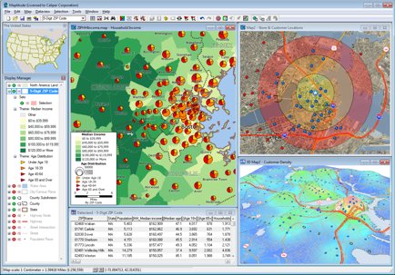
MAPTITUDE
Maptitude is a geographic information system (GIS) software, used to store geographic databases, create maps, analyze spatial data, and perform geographic analyses.
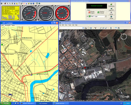
GPS TRACKMAKER
GIS software that allows two-way communication between GPS devices and computers, enabling the visualization and editing of data in a simple manner, as well as the storage of georeferenced information collected in the field.
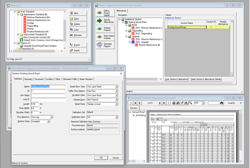
HIGHWAY DEVELOPMENT AND MANAGEMENT (HDM4)
The HDM-4 was conceived by the World Bank to support the planning, design, and management of road networks. HDM-4 is used globally by transportation agencies, engineering firms, and other organizations involved in the development and management of highway infrastructure. HDM-4 combines modules for assessing pavement performance, road work effects, evaluating road user costs, and estimating the costs and benefits of road investments. By using HDM-4, transportation agencies can identify the most cost-effective solutions to improve their road networks, such as selecting the most appropriate pavement design, setting maintenance priorities, and selecting optimal road rehabilitation strategies.
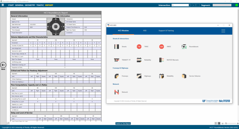
HIGHWAY CAPACITY SOFTWARE (HCS)
Computational packages that include different modules allow the faithful implementation of procedures from the most updated version of the Highway Capacity Manual (HCM) for capacity and level of service analysis. HCS modules can perform planning and operational-level analyses for surface streets, arterials, signalized intersections, roundabouts, highways, freeways, and interchanges.
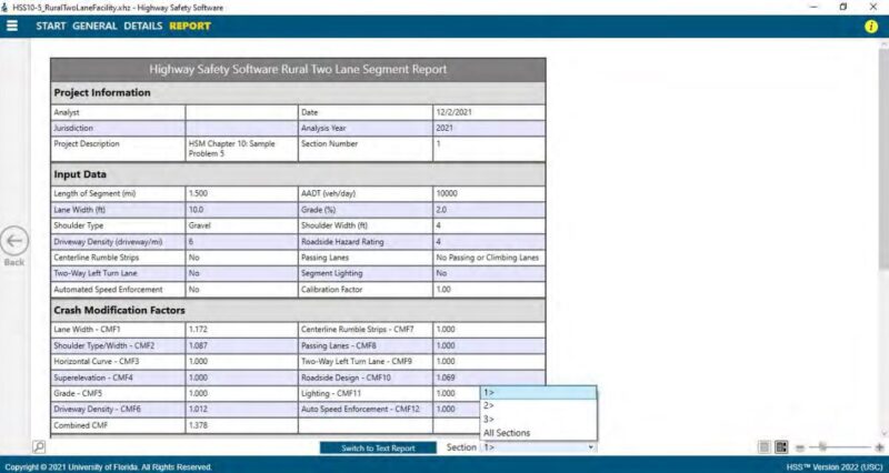
HIGHWAY SAFETY SOFTWARE (HSS)
Computational package that implements crash prediction models from the procedures of the Highway Safety Manual (HSM), 1st edition and its 2014 supplement, for road safety analysis based on the characteristics of the road infrastructure and demand.
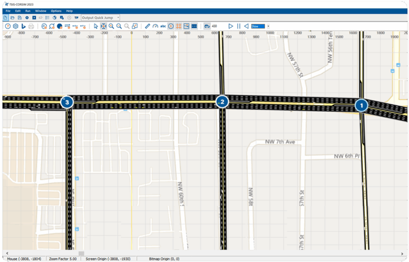
TSIS-CORSIM
TSIS-CORSIM is an integrated set of tools developed by the McTrans Center from FHWA funded research, for the microscopic-level modeling, simulation, and analysis of vehicular traffic. It is used to simulate traffic behavior with a high level of detail in urban and highway environments. It has integration with HCS (Highway Capacity Software), allowing results to be compared or used to feed simulations in CORSIM to model configurations beyond the HCM scope."
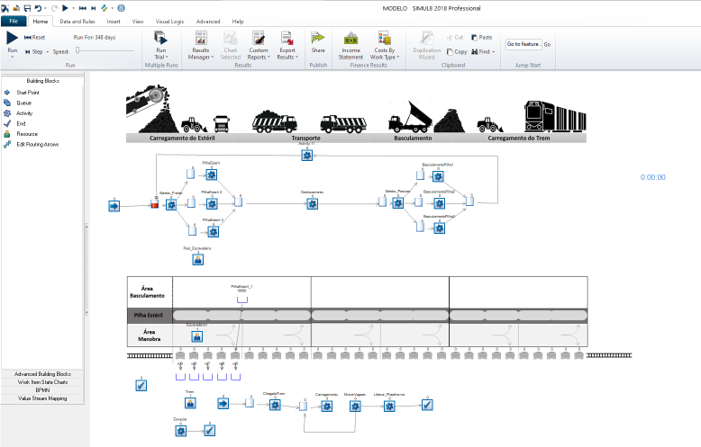
SIMUL8
Simul8 is a software tool used for simulation and modeling of complex systems and process flows. Simul8 allows users to create virtual simulations of real-world processes, including use of resources, capacity constraints, and statistical distributions of activity processing times to allow for understanding system behavior, simulating scenarios and support decision-making.
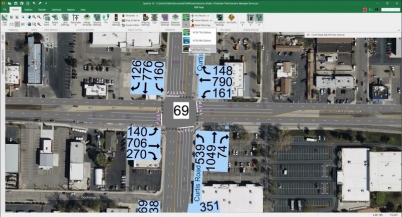
SYNCHRO STUDIO 12
Synchro Studio 12 is a software suite used by traffic engineers and planners for the analysis, optimization, and simulation of traffic operations. It combines tools for signal timing, capacity analysis, and microscopic traffic simulation with SimTraffic, enabling users to model complex road networks, evaluate various scenarios, and improve traffic flow by considering factors like vehicle movement, delays, and network performance.
VEHICLE TRACKING
Software from Autodesk's Architecture, Engineering & Construction collection, used for analyzing maneuvering areas based on the technical specifications of different vehicles. It allows for precise dimensioning road spaces, reducing the need for on-site simulations and optimizing project time."
OUR CLIENTS
Infraplan has a diverse portfolio of clients served since its foundation, including investors, developers, builders, and operators of infrastructure and transportation systems, as well as large-scale development projects.


FEATURED PORFOLIO
TRAFFIC MODELING FOR THE CONCESSION OF MS-112 AND BR-158/436/MS
Traffic modeling for the structuring of the tolling and concession of the BR 158/436/MS and MS-112 highway system, in response to the Expression of Interest Procedure from the Government of the State of Mato Grosso do Sul.
Photo: Edemir Rodrigues
All projects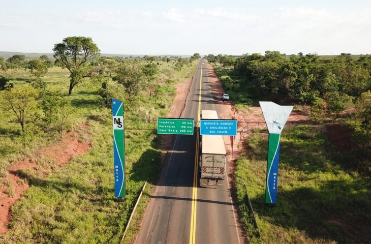
TRAFFIC AND SAFETY STUDY FOR INDUSTRIAL COMPLEX ALUMAR
Traffic study for optimizing traffic flow and improving safety for vehicles and pedestrians on the road network of the industrial complex of the Aluminum Consortium of Maranhão (Alumar), located in the municipality of São Luís/MA.
Photo: Alumar
All projects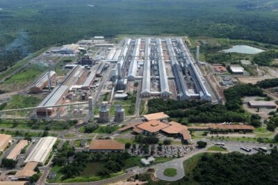
DEMAND AND REVENUE FORECASTING FOR THE BR 153/414/080 TO/GO ROAD SYSTEM
Traffic study to determine potential demand and toll revenue forecasts, aiming to support feasibility analyses for the BR 153/414/080 TO/GO road system concession.
Photo: DNIT
All projects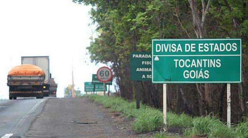
SIZING OF ORE TRANSPORTATION SYSTEM IN THE COMPLEX S11D
Logistic study, including process simulation and traffic microsimulation, for the sizing of the ore transportation system between the waste dump and the railway reverse loop of the S11D – Eliezer Batista Complex, owned by Vale, located in Parauapebas/PA
Photo: Ricardo Teles
All projectsPROPOSITION OF STATEWIDE LOGISTICS ROAD INVESTIMENTS FOR TOCANTINS
Specialized technical assistance in traffic and transportation engineering for the elaboration of a comprehensive diagnosis and proposition of road investments to minimize agro-logistic bottlenecks in the state of Tocantins.
Photo: Tocantins State Governnment
All projects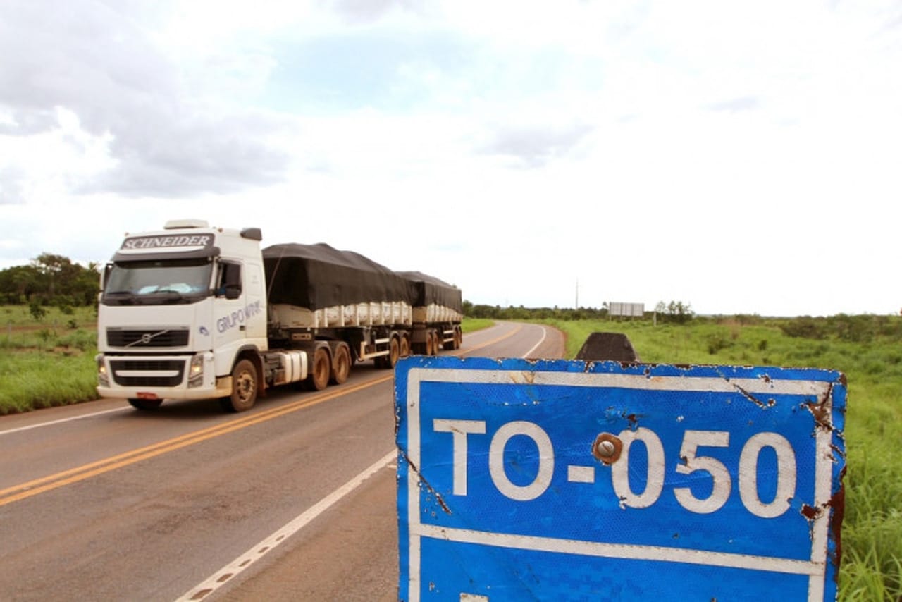
MOBILITY STUDY FOR THE MUNIIPALITY OF NOVA MUTUM, MT, Brazil
Traffic and transportation study to improve mobility in the municipality of Nova Mutum/MT, including the development of the Urban Mobility Plan, Immediate Traffic Action Plan, and Urban Perimeter Adjustment Plan for BR-163 highway.
Photo: ity of Nova Mutum
All projects
ENHANCEMENT PROPOSAL FOR THE ROAD SYSTEM OFIGUAÇU NATIONAL PARK
Evaluation, proposal, and budgeting of the necessary adjustments and innovations to the internal transportation system of the Iguaçu National Park, as part of the structuring services for the concession for a new administration.
Photo: Cataratas do Iguaçu National Park
All projectsPD&E OF NEW BRIDGE LINK BETWEEN PORT CITY SANTOS AND GUARUJÁ
Project Development & Environmental study (DP&E) to evaluate the implementation of alternatives for a new road link between the port cities of Santos and Guarujá, on the coast of the state of São Paulo.
Photo: Ecovias
All projects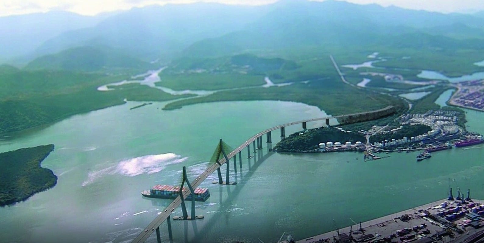
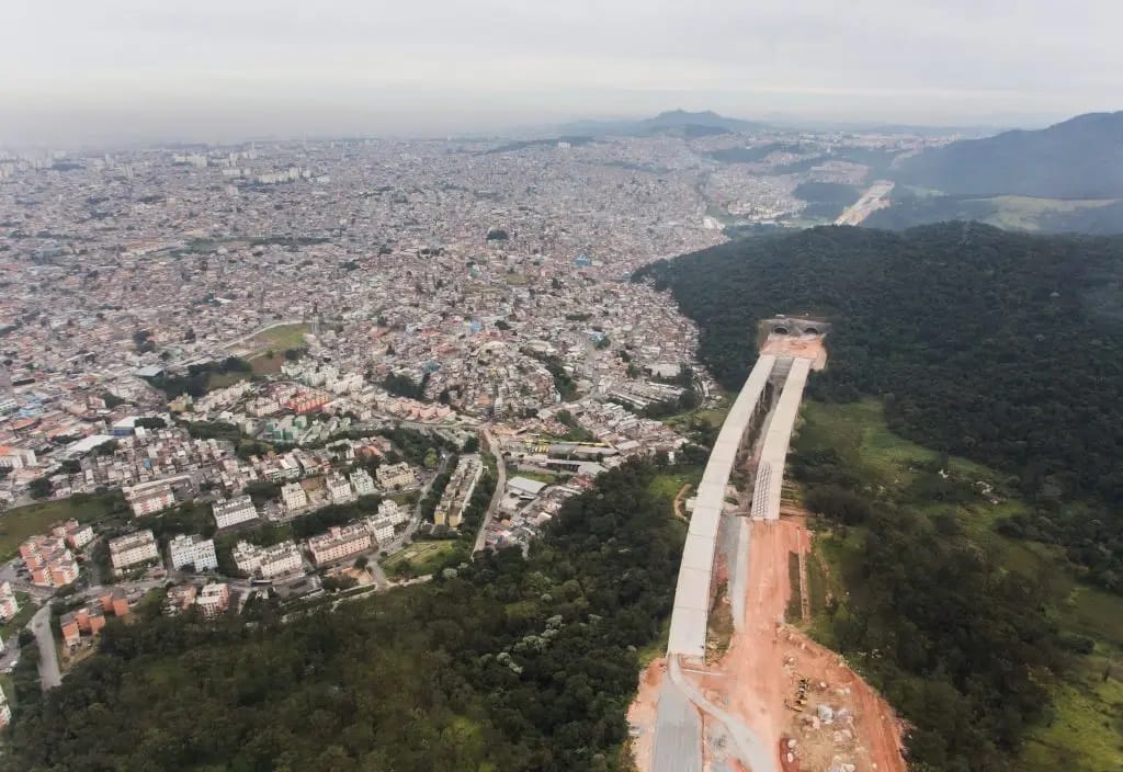
DEMAND MODELING FOR NORTH SECTION OF SÃO PAULO METRO BELTWAY
Demand modeling and toll revenue forecasting to support feasibility studies for the public-private partnership (PPP) of the northern section of São Paulo metro beltway (SP-021).
Photo: São Paulo state government
All projects